Tuesday, May 19, 2026: Storms moving in from Mexico could reach the Valley overnight
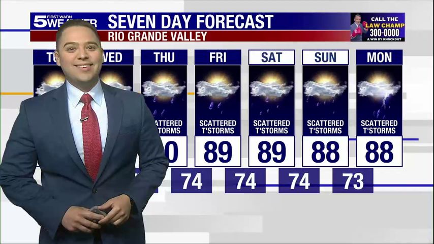
The Storm Prediction Center has placed the Rio Grande Valley under a level 1 out of 5 risk for severe thunderstorms overnight, according to the First Warn 5 Weather Team.
Isolated strong or severe thunderstorms could occur after midnight and the chance of rain sits at 30 percent.
The weather team said a round of storms could move in from Nuevo León as early as 7 p.m., but is expected to weaken before arriving. Thunderstorms developing west of Laredo also have the potential to move south into the Valley overnight.
The storms are expected to form along and ahead of a weak cold front and a couple of disturbances across the mountains in Mexico.
The main threats include lightning, winds of 58 mph or greater, and heavy rain that could lead to localized flooding. To be considered severe, a storm must have winds of 58 mph or more and/or hail up to one inch, according to the weather team.
Torrential rainfall that can lead to flash flooding is also a threat. Isolated hail up to quarter size or one inch or more, is possible but the chance of hail is lower than the wind threat.
Download our free KRGV FIRST WARN 5 Weather app for the latest updates right on your phone.
You can also follow our KRGV First Warn 5 Weather team on Facebook and Twitter.
More News